
Alerts in Parks
Park alerts include fire bans, boil water advisories, prohibited activities and general park notices.
 Algonquin Provincial Park -
Park Notice
Algonquin Provincial Park -
Park Notice
-Opeongo Access Point:
For backcountry users beginning or ending their trip at Lake Opeongo (Access Point 11), please note that from the 2026 season onward the Opeongo Access Point Office will be closed. Visitors requiring information can visit the Opeongo Store, or for information and permits they can visit the East or West Gates, call the information line at: 705-633-5572, or utilize the complimentary Wi-Fi.
-Lake of Two Rivers Campground Office:
Please note that from the 2026 season onward the Lake of Two Rivers Campground Office will be closed. Visitors requiring information, permits, or firewood can visit the Mew Lake Campground Office, or call the information line at: 705-633-5572.
-Kawawaymog (Round) Lake Access Point
For backcountry users beginning or ending their trip at Kawawaymog Lake (Access Point 1), please note that from the 2026 season onward, the Kawawaymog Access Point Office will be closed. Visitors requiring information can call the Algonquin Information Line at: 705-633-5572, or utilize the complimentary Wi-Fi at the Kawawaymog Access Point.
Algonquin Provincial Park -
Park Notice
- Tea Lake and Canisbay Lake Campgrounds 416-270-5137
- Mew Lake and Lake of Two Rivers Campgrounds 705-571-3528
- Pog Lake, Kearney Lake and Whitefish Lake Campgrounds 705-571-3621
- Rock Lake and Raccoon Lake Campgrounds 705-571-1574
In the event of a medical emergency or critical incident, please contact 911.
For general inquiries please call our information line: 705-633-5572
This phone line is answered Monday to Friday from 9:00am to 4:00pm eastern standard time. Please note this mailbox is not monitored over the weekend.
Algonquin Provincial Park -
Park Notice
- The Hardwood Lookout Trail will be closed on five weekends, including Fridays and holiday Mondays: Sept. 11-13, Sept. 18-20, Sept 25-27, Oct. 2-4, and Oct. 9-12 (Canadian Thanksgiving).
- Tea Lake Campground, including the comfort station is open for day use on fall weekends only beginning September 12 until October 12.
- To access the Booth’s Rock Trail between September 12 and October 18, a special daily vehicle permit is required.
- The Fork Lake Trail is a new 2.4 km trail at the Algonquin Visitor Centre. Please note: this trail offers short, steep climbs and is rated as difficult.
Algonquin Provincial Park -
Park Notice
- Daily: 8:00 am - 6:00 pm
West Gate Office:
- Daily: 8:00 am - 6:00 pm
Visitor Centre:
- Daily: 9:00 am – 5:00 pm
- Friends of Algonquin Park Bookstore & Nature Shop, Algonquin Art Room, viewing deck, exhibits, and a dining area with coffee, cold drinks and snacks.
Canisbay Lake Office:
-- Sunday - Thursday: 9:00 am - 6:00 pm
-- Friday - Saturday: 9:00 am - 8:00 pm
Mew Lake Campground Office:
-- Sunday - Thursday: 9:00 am - 6:00 pm
-- Friday - Saturday: 9:00 am - 8:00 pm
Pog Lake Campground Office:
-- Sunday - Thursday: 9:00 am - 6:00 pm
-- Friday - Saturday: 9:00 am - 8:00 pm
Rock Lake Office:
-- Sunday - Thursday: 9:00 am - 6:00 pm
-- Friday - Saturday: 9:00 am - 8:00 pm
Canoe Lake Access Point Office:
-- Friday – Tuesday: 8:00 am – 3:00 pm
-- Wednesday – Thursday: Closed
Shall Lake Access Point Office:
- Friday - Tuesday: 8:30 am – 4:00 pm
- Wednesday – Thursday: Closed
Sand Lake Gate Access Point Office:
Daily: 9:00 am- 5:00 pm
Achray/Grand Lake Access Point Office:
-Daily: 10:00 am - 6:00 pm
Kearney/Magnetawan Access Point Office:
- Daily: 8:00 am - 5:00 pm
Brent Office:
- Daily: 8:00 am – 3:45 pm
Kiosk Office:
- Daily: 8:00 am – 7:00 pm
Trailer Sanitation Stations:
- Minnesing (km 23): Open
- Sunday Lake (km 35.6): Open
- Rock Lake: Open
Algonquin Provincial Park -
Park Notice
Low Water Alerts
- Varley Lake from Carl Wilson Lake
- Latour Creek north of Rosebary Lake
- Carcajou Creek north towards Greenleaf Lake
- Craig Lake
- David Creek off of Mubwayaka Lake
-The creek between Timberwolf Lake and Misty Lake
- The Highview Cabin will be closed for the 2026 season for repairs and maintenance.
- Provoking Falls Bridge Closure: The Provoking Falls bridge on the Highland Backpacking Trail is CLOSED due to safety concerns. The bridge has been removed. A re-route has been posted and provided, it will add an additional 2.5 km.
Arrowhead Provincial Park -
Park Notice
We are investing in the construction of a new comfort station this season in East River Campground (campsites 200–351) at Arrowhead Provincial Park. Visitors may encounter construction zones and noise from 8am to 5pm, Monday to Friday.
The Comfort Station between campsites 244 and 262 in East River Campground will be closed for construction. The nearest operating comfort station will be located at the entrance to East River Campground.
To facilitate this work, campsite closures have been put in place.
Arrowhead Provincial Park -
Park Notice
Construction is underway to replace a set of stairs on the Stubb’s Falls Trail, just after the bridge on the west side of the trail. Work will continue until further notice.
The trail remains accessible around the construction area; however, the detour includes an uphill section. Please use caution, stay alert for construction hazards, and follow any posted signage while travelling through the area.
Thank you for your patience while we make improvements to the trail.
Arrowhead Provincial Park -
Park Notice
Water has been shut off to the Lumby, East River and Roe Campgrounds. Comfort Stations, flush toilets, water taps, and the trailer sanitation station are closed.
Please be advised that at this time water services are available at the Mini Comfort Station, which is located in the East River Campground. Potable water is available here as well as showers, flush toilets, a dish washing station and winterized trailing filling station.
Washrooms and potable water are also available at the Visitor Centre/Park Store.
Arrowhead Provincial Park -
Park Notice
Construction is underway on boardwalk areas of the beaver meadow trail. Work will continue until further notice.
The trail remains closed.
Thank you for your patience while we make improvements to the trail.
Awenda Provincial Park -
Park Notice
Cell phone reception may be unreliable throughout this park. Plan ahead before arriving and check the local weather forecast prior to your visit.
Bass Lake Provincial Park -
Park Notice
If a BGA bloom is confirmed and affects the Bass Lake Provincial Park swimming area, Ontario Parks will work with partner agencies to issue advisories and alerts to help inform the public.
Visitors are encouraged to familiarize themselves with information about blue-green algae and follow recommended precautions.
Bon Echo Provincial Park -
Park Notice
Notice: Loop 3 (Abes) of the Abes and Essens Hiking Trail is CLOSED between campsites 529 and 530 due to storm damage. All 5 campsites on the trail remain open.
Bon Echo Provincial Park -
Park Notice
The Pet Exercise Trail and the South Beach Parking Area will be closed for the 2026 season due to park campground expansion project. For South beach access please park at the Main Beach or Bon Echo Creek trail parking, and access across the foot bridge.
Bon Echo Provincial Park -
Park Notice
Due to freezing temperatures, the water system in the Mazinaw campground, including the trailer fill and sanitation station as well as comfort stations will be closed after October 18, 2026. The heated Bon Echo Lake comfort station will remain open until December 13, 2026, which includes washrooms, showers, drinking water and a dishwash station.
Bonnechere Provincial Park -
Park Notice
Bronte Creek Provincial Park -
Park Notice
The pool will remain closed for the summer of 2026 as the project progresses.
Bronte Creek Provincial Park -
Park Notice
Obtain your daily vehicle permit up to five days in advance to guarantee your day use spot at this park. Visit the Ontario Parks day use page to learn more.
 Bronte Creek Provincial Park -
Prohibited Activities
Bronte Creek Provincial Park -
Prohibited Activities
Recreational use of drones is not permitted.
 Bronte Creek Provincial Park -
Warning
Bronte Creek Provincial Park -
Warning
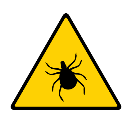
Ticks are found on this landscape.
 Bronte Creek Provincial Park -
Warning
Bronte Creek Provincial Park -
Warning
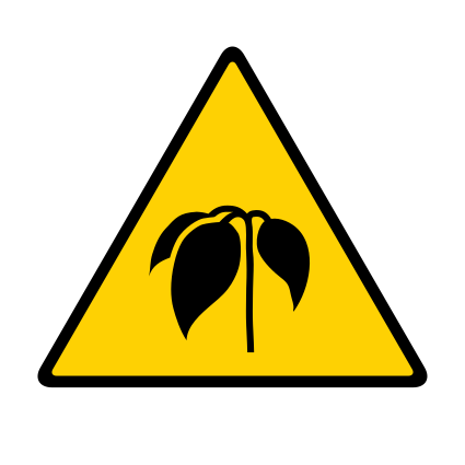
Poison ivy is found on this landscape.
Charleston Lake Provincial Park -
Park Notice
The Slim Bay Bridge on the Tallow Rock Bay east trail was badly damaged over the winter and has now been removed from service.
The bridge will not be in place for the remainder of the 2026 operating season.
As there is no longer a bridge, the 10 km loop on the Tallow Rock Bay Trail is no longer available.
Interior campers travelling to Slim Bay campsites will now have a 7 km hike to access the sites. Sites are still accessible by water; however, motorboats are not permitted in Slim Bay.
Interior campers travelling to the Hidden Cove site will have a 6 km hike to access the site.
Craigleith Provincial Park -
Park Notice
 Devon Road Mesa Provincial Park -
Fire Ban
Devon Road Mesa Provincial Park -
Fire Ban
This park is currently under a fire ban.
Driftwood Provincial Park -
Park Notice
Visitors are encouraged to familiarize themselves with information about blue-green algae and follow recommended precautions.
Fitzroy Provincial Park -
Park Notice
Fitzroy Provincial Park -
Park Notice
 Fushimi Lake Provincial Park -
Drinking Water Advisory
Fushimi Lake Provincial Park -
Drinking Water Advisory
A boil water advisory is in effect. Please bring water to a rolling boil for at least 1 full minute before using for drinking, food preparation and infant formula, and brushing teeth.
 Gibson River Provincial Park -
Prohibited Activities
Gibson River Provincial Park -
Prohibited Activities
Camping is prohibited.
Gibson River Provincial Park -
Prohibited Activities
No campfires or open fires are permitted at any time.
 Gibson River Provincial Park -
Prohibited Activities
Gibson River Provincial Park -
Prohibited Activities
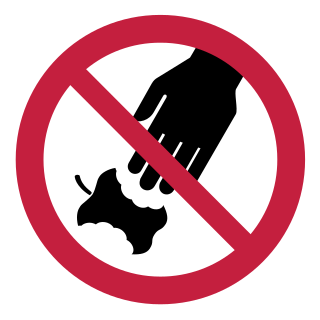
No littering
 Gibson River Provincial Park -
Prohibited Activities
Gibson River Provincial Park -
Prohibited Activities
No hunting
 Gibson River Provincial Park -
Prohibited Activities
Gibson River Provincial Park -
Prohibited Activities
No horse back riding
 Gibson River Provincial Park -
Prohibited Activities
Gibson River Provincial Park -
Prohibited Activities
No alcohol
 Gibson River Provincial Park -
Prohibited Activities
Gibson River Provincial Park -
Prohibited Activities
No mechanized travel
Gibson River Provincial Park -
Prohibited Activities
Recreational use of drones is not permitted.
Gibson River Provincial Park -
Park Notice
This is a non-operating park. There are no facilities or activities at this park.
Gibson River Provincial Park -
Prohibited Activities
There is no parking available at this park.
Hardy Lake Provincial Park -
Prohibited Activities
Camping is prohibited.
Hardy Lake Provincial Park -
Prohibited Activities
No campfires or open fires are permitted at any time.
Hardy Lake Provincial Park -
Prohibited Activities
No littering
Hardy Lake Provincial Park -
Prohibited Activities
No hunting
Hardy Lake Provincial Park -
Prohibited Activities
No horse back riding
Hardy Lake Provincial Park -
Prohibited Activities
No alcohol
Hardy Lake Provincial Park -
Prohibited Activities
No mechanized travel
Hardy Lake Provincial Park -
Prohibited Activities
Recreational use of drones is not permitted.
Hardy Lake Provincial Park -
Park Notice
This is a non-operating park. There are no facilities or activities at this park.
Hardy Lake Provincial Park -
Park Notice
There is limited parking at this park.
Inverhuron Provincial Park -
Park Notice
The Municipality of Kincardine will be undertaking repairs to the Albert Road Bridge. Construction is scheduled to begin around the end of August 2026 and will include waterproofing and paving. The project is expected to take approximately one month to complete, with work anticipated to conclude by the end of September 2026.
Please keep this in mind when planning your route to Inverhuron Provincial Park.
Kap-Kig-Iwan Provincial Park -
Park Notice
Please be advised that construction is taking place on Kap-Kig-Iwan Road between Highway 11 and the park entrance.
Visitors should expect delays and allow extra travel time when travelling to and from the park. Please follow all posted signage and traffic control directions.
Thank you for your patience and understanding.
Killarney Provincial Park -
Park Notice
Killarney Provincial Park -
Park Notice
Kopka River Provincial Park -
Park Notice
Wildlife monitoring cameras or ecological monitoring devices are in use. Any photos containing images of members of the public are deleted according to Ontario Park’s photo policy (under development). Please contact the park superintendent, if you would like more information on this topic. Personal information is collected under the authority of Section 29 of the Provincial Parks and Conservation Reserves Act.
Lake Superior Provincial Park -
Park Notice
Wildlife monitoring cameras or ecological monitoring devices are in use. Any photos containing images of members of the public are deleted according to Ontario Park’s photo policy (under development). Please contact the park superintendent, if you would like more information on this topic. Personal information is collected under the authority of Section 29 of the Provincial Parks and Conservation Reserves Act.
Lake Superior Provincial Park -
Prohibited Activities
Recreational use of drones is not permitted.
Lake Superior Provincial Park -
Park Notice
Please be advised that Gargantua Road is closed for maintenance.
As a result, the following access points along Gargantua Road will not be accessible until further notice:
- Belanger Lake
- Gargantua Lake
- Miron Lake
- Buckshot Lake
- Gargantua Bay
Campsites in the following Coastal Trail zones will also be temporarily closed:
- Chalfant Cove
- Chair Island
- Warp Bay
- Gargantua North
- Gargantua South
- Rhyolite Cove
- Mermaid Lagoon
Check back for updates.
Lake Superior Provincial Park -
Park Notice
Please be advised that the Agawa Rock Pictographs Trail is closed to the public for the season as of September 11th, 2026.
This is to allow for private Indigenous Ceremonies at this sacred site and due to the high prevalence of hazardous weather conditions in the fall.
We thank you in advance for respecting this closure.
Lake Superior Provincial Park -
Park Notice
Agawa Rock is an active sacred site. Local Indigenous communities/First Nations have requested that dogs not be present at the Agawa Rock Pictographs, for cultural reasons. Visitors intending to bring their dog are advised to bring another human companion to take turns waiting with the dog while the other person walks down to the pictographs site. There are benches available near the Agawa Rock trailhead where visitors can alternate waiting with their dog. Dogs are permitted on other park trails, provided they are kept on a leash not exceeding 2 meters.
Off-leash Pet Exercise Areas are located at Agawa Bay north of the campground, near the Visitor Centre, and at the north end of Old Woman Bay. Please note that the beach directly in front of the Agawa Bay Campground, Katherine Cove, and the area south of the Pet Exercise Area at Old Woman Bay are designated as Swimming Areas. Pets are not permitted past the treeline in these areas, even if they are on a leash.
Lake Superior Provincial Park -
Park Notice
Please note that a physical permit must be displayed on all vehicles at Lake Superior Provincial Park.
FALL OFFICE HOURS:
Park Office (Red Rock Lake): Open daily from 8:00 am – 7:00 pm
Visitor Centre (Agawa Bay): Open daily from 8:00 am – 7:00 pm
Campground Gatehouses (Agawa Bay & Rabbit Blanket Lake): Closed for the season. Please register/check-in at the Park Office or Visitor Centre.
LATE ARRIVALS:
Visitors with camping reservations arriving after office hours may head directly to their campsite and check-in the following morning when offices open.
Lake Superior Provincial Park -
Park Notice
Hunting is permitted in part of Lake Superior Provincial Park for moose, grouse and varying hare only. The following is a summary of hunting is permitted and when the hunting seasons are open.
Open Seasons 2026:
- Grouse – October 17th to December 15th
- Hare – October 17th to December 15th
- Adult & Calf Moose (Ontario Residents) – October 17th to November 15th
- Adult & Calf Moose (Non-Residents) – October 19th to November 15th
For the 2026 season hunting is permitted only in the part of Lake Superior Provincial Park lying east of Highway 17 and north of the south boundaries of Brimacombe and Broome Townships. Hunting is not permitted within the rest of the park.
Visitors should note that the following trails are located within areas open to hunting:
- Nokomis Trail
- South Old Woman River Trail
- Trapper’s Trail (closed for the season as of October 17th, 2026)
A map illustrating the area open to hunting, as well as copies of the 2026 Hunting Regulations Summary, can be obtained from the Park Office, the Ministry of Natural Resources District Office in Wawa and Sault Ste. Marie, or online: www.ontario.ca/hunting.
Lake Superior Provincial Park -
Park Notice
Please be advised that Trapper’s Trail is closed for the season as of October 10th, 2026, due to the potential for hunting activity.
The following trails are not closed, but visitors should be aware they are also located within areas that are open to hunting as of the same date and exercise caution:
- Nokomis Trail
- South Old Woman River Trail
Hikers are encouraged to wear hunter orange as a safety precaution and are reminded that dogs must be kept on a leash at all times.
Lake Superior Provincial Park -
Drinking Water Advisory
Location: Agawa Bay - A boil water advisory is in effect. Please bring water to a rolling boil for at least 1 full minute before using for drinking, food preparation and infant formula, and brushing teeth.
Mashkinonje Provincial Park -
Park Notice
This trail is temporarily closed. Please check signage and information at the park for more information.
McRae Point Provincial Park -
Park Notice
Michipicoten Island Provincial Park -
Park Notice
Wildlife monitoring cameras or ecological monitoring devices are in use. Any photos containing images of members of the public are deleted according to Ontario Park’s photo policy (under development). Please contact the park superintendent, if you would like more information on this topic. Personal information is collected under the authority of Section 29 of the Provincial Parks and Conservation Reserves Act.
Misery Bay Provincial Park -
Park Notice
Obtain your daily vehicle permit up to five days in advance to guarantee your day use spot at this park. Visit the Ontario Parks day use page to learn more.
Misery Bay Provincial Park -
Park Notice
North Beach Provincial Park -
Park Notice
Pancake Bay Provincial Park -
Park Notice
Pancake Bay Provincial Park estimates the work will begin in June and conclude in the fall of 2026.
Pancake Bay Provincial Park -
Park Notice
Pancake Bay Provincial Park -
Park Notice
The Lookout and Pancake Falls Trail of the Edmund Fitzgerald Trail System remain open to the public.
Petroglyphs Provincial Park -
Park Notice
In order to respect the spiritual and ceremonial dignity of the Petroglyphs site, photography and the use of digital devices is not permitted at the glyph site. Visitors are asked to keep cell phones in their pockets at the site. Photography is permitted throughout the rest of the park.
Dogs:
The indigenous community has requested that dogs not be present at the Petroglyphs site. Visitors intending to bring their dog are advised to bring another human companion to take turns waiting with the dog while the other person enters the Visitor Centre or walks down to the glyph site. There are benches available 100m up the path from glyph site where visitors can alternate waiting with their dog. Dogs are permitted throughout the rest of the park as long as they are on leash and under control.
Swimming:
In order to protect the fragile ecosystem of this unique lake, swimming is prohibited at McGinnis Lake.
Hiking:
Visitors are asked not to start any hiking trails after 3:00 pm as there is not time to complete the trails before 5:00 pm when visitors are asked to leave the park.
Please arrive well before 3:00 pm if planning to go for a hike.
Pinery Provincial Park -
Park Notice
Wildlife monitoring cameras or ecological monitoring devices are in use. Any photos containing images of members of the public are deleted according to Ontario Park’s photo policy (under development). Please contact the park superintendent, if you would like more information on this topic. Personal information is collected under the authority of Section 29 of the Provincial Parks and Conservation Reserves Act.
Port Burwell Provincial Park -
Park Notice
Presqu'ile Provincial Park -
Park Notice
Presqu'ile Provincial Park -
Park Notice
Thank you for your understanding as we work to improve the park experience for all.
Presqu'ile Provincial Park -
Park Notice
If you wish to utilize the trail system, parking is available by nearby access points at the Camp Office, Nature Centre and Lighthouse Centre.
Thank you for your understanding and cooperation.
Quetico Provincial Park -
Park Notice
• Batchewaung Lake
• Sue Falls
• Cirrus
• Quetico
Due to impacts from nearby forest fires, the following backcountry entry points at Quetico Provincial Park will remain closed until October 31st, 2026:
• Agnes Lake
• Agnes Lake/Basswood Basecamp
• Baptism Creek
• Basswood River
• Bottle River
• Boundary Point – Saganagons
• Carp Lake
• Falls Chain Lakes
• Fly-In Access – Cache Bay
• Kahshahpiwi
• Kings Point Fly-In
• Knife Lake
• Mack Lake Fly-In
• Maligne River
• Man Chain Lakes
• McAree Lake
• Pickerel Lake
• Sarah Lake
• Three Mile
To ensure your planned route is not impacted by these closures, please refer to https://www.ontarioparks.ca/pdf/maps/quetico/limited-backcountry-reopening.pdf
Additionally, you may call the Quetico Information Line at 807-597-2735 for trip planning assistance.
If you would like to change or cancel your reservation, please contact our call centre at 1-888-668-7275 (open daily; 7am-9pm ET) and speak with a reservation agent, no change or cancellation fees will apply.
We understand that this may affect your plans and apologize for the inconvenience.
Quetico Provincial Park -
Park Notice
Personal information is collected under the authority of the Provincial Parks and Conservation Reserves Act, 2006. Images inadvertently capturing suspected criminal, safety, or security violations, may be disclosed to the appropriate law enforcement agency. Any remaining records that contain the image of an identifiable individual will be deleted or altered to make the individuals unidentifiable.
René Brunelle Provincial Park -
Drinking Water Advisory
A boil water advisory is in effect. Please bring water to a rolling boil for at least 1 full minute before using for drinking, food preparation and infant formula, and brushing teeth.
Rock Point Provincial Park -
Drinking Water Advisory
Location: Entire Park - A boil water advisory is in effect. Please bring water to a rolling boil for at least 1 full minute before using for drinking, food preparation and infant formula, and brushing teeth.
Rock Point Provincial Park -
Park Notice
Cell phone reception may be unreliable throughout this park. Plan ahead before arriving and check the local weather forecast prior to your visit.
Rondeau Provincial Park -
Park Notice
Rondeau Provincial Park -
Warning
Ticks are found on this landscape.
Rondeau Provincial Park -
Park Notice
Rondeau Provincial Park -
Park Notice
Rondeau Provincial Park -
Warning
Poison ivy is found on this landscape.
Rondeau Provincial Park -
Prohibited Activities
No horse back riding
Rondeau Provincial Park -
Prohibited Activities
Recreational use of drones is not permitted.
Rushing River Provincial Park -
Drinking Water Advisory
A boil water advisory is in effect. Please bring water to a rolling boil for at least 1 full minute before using for drinking, food preparation and infant formula, and brushing teeth.
Samuel de Champlain Provincial Park -
Park Notice
The Visitor Centre remains open and continues to operate as both a museum and visitor information/check-in location.
The Park Store remains open, offering rentals, firewood, ice and merchandise sales.
Recreational areas and facilities open in 2026 include:
• Moore Lake, including our day-use area
• Bagwa and the Babawasse Campground beach
• Access to the Amable du Fond River towards Campion Rapids.
• Long Lake and the Mattawa River access/boat launch
• Trailer fill and dump station
A limited number of hiking trails will open, as trail maintenance efforts will be ongoing throughout the summer.
Samuel de Champlain Provincial Park -
Park Notice
Restoration efforts throughout the entire park are ongoing and may cause noise and intermittent disruptions. Please respect all closures and maintain a safe distance from work crews to ensure everyone's safety. We appreciate everyone's understanding and patience during this period.
Please continue to check our Alerts page on our website for updates and notifications (i.e. boil water advisories, fire bans, etc.). http://www.ontarioparks.com/park/samueldechamplain/alerts
Ontario Parks staff will also be updating our social media accounts:
Facebook: https://www.facebook.com/SamueldeChamplainPP
Instagram: https://www.instagram.com/samueldechamplainpp/
Sandbanks Provincial Park -
Park Notice
Sandbanks Provincial Park -
Park Notice
Thank you for your patience as we make these enhancements to improve our infrastructure and better serve our park visitors.
Short Hills Provincial Park -
Prohibited Activities
No alcohol
Short Hills Provincial Park -
Prohibited Activities
No mechanized travel
Short Hills Provincial Park -
Prohibited Activities
No littering
Short Hills Provincial Park -
Prohibited Activities
No hunting
Short Hills Provincial Park -
Prohibited Activities
Camping is prohibited.
Short Hills Provincial Park -
Prohibited Activities
Recreational use of drones is not permitted.
Short Hills Provincial Park -
Warning
Ticks are found on this landscape.
Short Hills Provincial Park -
Park Notice
Short Hills Provincial Park -
Park Notice
Short Hills Provincial Park is pleased to announce a phased reopening of several trails following extensive damage assessments and restoration work completed after recent flooding events. While many areas are ready to safely welcome visitors back, some sections remain closed while significant repairs and infrastructure replacement projects continue.
Trails Reopening Week of August 24
The following trails have been assessed and are considered safe for public access:
The Pines Trail
Laura Secord Trail
Paleozoic Path
Minor trail maintenance and cleanup will continue over the coming week to address localized damage and improve trail conditions.
Swayze Falls Trail (Partial Reopening)
A portion of Swayze Falls Trail will reopen to visitors.
Open sections will provide:
A route from the Roland Road Parking Lot to the Bruce Trail entrance on Effingham Road along the west side of the park
A travel corridor connecting the Roland Road Parking Lot and Black Walnut Trail near the Pelham Road Parking Lot.
Trail Reopening Week of August 31
Hemlock Valley Trail
Trails Remaining Closed
Terrace Creek Trail remains closed until further notice.
Inspections have confirmed a complete structural failure of the trail bridge. The bridge must be fully replaced before the trail can safely reopen.
Swayze Falls Trail Northern Section Closure
The northern section of Swayze Falls Trail will remain closed pending bridge replacement.
Inspections have confirmed a complete structural failure of the trail bridge. The bridge must also be fully replaced before the trail can safely reopen.
Bridge removal and replacement planning is expected to proceed after priority trail washout repairs have been completed.
Black Walnut Trail Update
Black Walnut Trail will be accessible from:
Pelham Road Parking Lot
Wiley Road Parking Lot
Visitors will also be able to access the Bruce Trail through:
Very Berry Trail
Laura Secord Trail
Closed Section
The northwest section of Black Walnut Trail remains closed due to significant washouts and erosion damage.
Repair work is expected to begin later this week and continue into next week.
Visitors are reminded to obey all trail closure signs and barriers. Closed areas may contain unsafe conditions, damaged infrastructure, and active construction zones.
Short Hills Provincial Park -
Park Notice
Please refer to the Canadian Food Inspection Agency (CFIA) website and park kiosks for additional information and pictures.
https://inspection.gc.ca/plants/plant-pests-invasive-species/invasive-plants/fact-sheets/japanese-stiltgrass/eng/1331745159167/1331745245097
Why it’s a problem
Japanese stiltgrass can form dense stands that outcompete native vegetation. It reduces the regeneration of native woody species and the overall biodiversity of the invaded ecosystem.
What it looks like
Japanese stiltgrass is a sprawling grass. Stems are 40-120 cm long and 1-1.5 mm thick. The lower portion of the plant is prostrate while the upper portions and flowering branches are erect. It roots at its stem nodes. Leaf blades are pale green, narrowly elliptic, 4–9 cm long and 5–15 mm wide, with a characteristic shiny midrib. Leaf sheaths are shorter than internodes. Inflorescences are terminal racemes, 3-9 cm in length.
Where it’s found
Native to Asia, this species has naturalized in the eastern U.S. and continues to spread in the northeast. One small population of Japanese stiltgrass has been confirmed and is under official control in southern Ontario.
How it spreads
Fruits and seeds are dispersed by water and can attach to clothing or animal fur. Bird seed, soil, nursery stock, hay, muddy tires, equipment, vehicles, and footwear are additional means of dispersal. Seeds can persist in the soil for as long as five years.
Regulations
Japanese stiltgrass is regulated as a pest in Canada under the Plant Protection Act. The species is prohibited and therefore importation and domestic movement of regulated plants and their propagative parts is not permitted. If found, regulatory action can be taken.
Similar species
Japanese stiltgrass is similar to the North American native white cutgrass (Leersia virginica). However, distinctive traits of Japanese stiltgrass include hairless nodes, smaller leaf blades, purple fall colouration, and a shinier blade midrib. Moreover, Japanese stiltgrass is an annual weed with fibrous roots and a spike-like inflorescence, whereas Leersia species have rhizomes and a panicle type of inflorescence. Japanese stiltgrass may also be mistaken for another North American native, deertongue panicgrass (Dichanthelium clandestinum), as well as for small carpetgrass (Arthraxon hispidus).
What to do about it
Please contact your local CFIA office if you think you have found Japanese stiltgrass or other regulated invasive plants. The CFIA will follow-up to determine if further action is needed.
*Invasive plants are plant species that can be harmful when introduced into new areas. These species can invade agricultural and natural areas, causing serious damage to Canada's economy and environment. To find out more, visit www.inspection.gc.ca/invasive or contact CFIA’s Invasive Alien Species and Domestic Programs section at cfia.ias-eee.acia@canada.ca. To find your area or regional CFIA office, visit http://www.inspection.gc.ca/about-the-cfia/offices/eng/1313255382836/1313256130232
Sioux Narrows Provincial Park -
Drinking Water Advisory
A boil water advisory is in effect. Please bring water to a rolling boil for at least 1 full minute before using for drinking, food preparation and infant formula, and brushing teeth.
Sleeping Giant Provincial Park -
Park Notice
Wildlife monitoring cameras or ecological monitoring devices are in use. Any photos containing images of members of the public are deleted according to Ontario Park’s photo policy (under development). Please contact the park superintendent, if you would like more information on this topic. Personal information is collected under the authority of Section 29 of the Provincial Parks and Conservation Reserves Act.
Sleeping Giant Provincial Park -
Park Notice
People or pets should not enter the water if it looks green or blue-green.
If you come in contact with algae, rinse off with clean water.
Turkey Point Provincial Park -
Park Notice
Beginning this fall, Ontario Parks will be replacing comfort stations at Turkey Point Provincial Park to enhance campground facilities. To accommodate construction, campgrounds will close earlier than usual for the 2026 season.
· Whippoorwill Campground will close on September 7, 2026.
· Walking Stick Woods Campground and Fin & Feather Campground will close on October 12, 2026.
Visitors are encouraged to use the campsite availability alert feature at reservations.ontarioparks.ca to receive notifications should campsite availability change due to adjustments in construction timelines.
We appreciate your patience and understanding as we complete these important infrastructure improvements to better serve park visitors.
Voyageur Provincial Park -
Park Notice
The Park Store will no longer be operating a hot food kitchen for cooked meals. The store will continue to offer snacks, coffee, cold food items, and basic camping essentials. Visitors are encouraged to plan ahead for meals during their visit.
Wabakimi Provincial Park -
Park Notice
Wildlife monitoring cameras or ecological monitoring devices are in use. Any photos containing images of members of the public are deleted according to Ontario Park’s photo policy (under development). Please contact the park superintendent, if you would like more information on this topic. Personal information is collected under the authority of Section 29 of the Provincial Parks and Conservation Reserves Act.
Wabakimi Provincial Park -
Park Notice
•Flindt River / Vista Rd
•Sassenach Lake
•Smye Lake
•Allanwater Bridge
The following reservation zones are open as of August 21st, 2026:
•Flindt
•Allanwater
•Wabakimi
-Only Wabakimi Lake and Lower Wabakimi Lake are open in this reservation zone.
Due to the impacts from nearby forest fires, all other entry points and reservation zones will remain closed until October 31st, 2026.
To ensure your planned route is not impacted by these closures, please refer to the re-opening maps on the Wabakimi maps page at www.ontarioparks.ca/park/wabakimi/maps
Please call our reservation call centre at 1-888-668-7275 for more information on reservations and bookings.
Wheatley Provincial Park -
Warning
Poison ivy is found on this landscape.
Wheatley Provincial Park -
Warning
Ticks are found on this landscape.
Wheatley Provincial Park -
Park Notice
There is limited parking at this park.
White Lake Provincial Park -
Drinking Water Advisory
A boil water advisory is in effect. Please bring water to a rolling boil for at least 1 full minute before using for drinking, food preparation and infant formula, and brushing teeth.
Beach Postings
A "posting" is an indication of elevated bacteria levels in the water, not intended as an indication of operational status.
| Park / Beach Name | Sample Date | Open / Posted |
|---|---|---|
| Aaron East Beach |
August 11, 2026 |

|
| Aaron Main Beach |
August 11, 2026 |
|
| Algonquin Achray - East |
August 25, 2026 |
|
| Algonquin Achray - West |
August 25, 2026 |
|
| Algonquin Canisbay Campground "A" |
August 31, 2026 |
|
| Algonquin Canisbay Day Use "B" |
August 31, 2026 |
|
| Algonquin East Beach |
August 31, 2026 |
|
| Algonquin Kearney Lake |
August 31, 2026 |
|
| Algonquin Kiosk Access |
September 1, 2026 |
|
| Algonquin Mew Lake |
August 31, 2026 |
|
| Algonquin Pog Lake A |
August 31, 2026 |
|
| Algonquin Pog Lake C |
August 31, 2026 |
|
| Algonquin Raccoon Lake |
August 31, 2026 |
|
| Algonquin Rock Lake A |
August 31, 2026 |
|
| Algonquin Rock Lake B |
August 31, 2026 |
|
| Algonquin Tea Lake Camp. |
August 31, 2026 |
|
| Algonquin Two Rivers Camp. |
August 31, 2026 |
|
| Algonquin Two Rivers Picnic |
August 31, 2026 |
|
| Algonquin Whitefish GC |
August 31, 2026 |
|
| Arrowhead Beach 1 |
August 6, 2026 |
|
| Arrowhead Beach 2 |
August 4, 2026 |
|
| Arrowhead Lumby |
August 4, 2026 |
|
| Arrowhead Roe |
August 6, 2026 |
|
| Arrow Lake Campground Beach |
August 17, 2026 |
|
| Awenda Beach 1 |
August 10, 2026 |
|
| Awenda Beach 2 |
August 10, 2026 |
|
| Awenda Beach 3 |
August 10, 2026 |
|
| Awenda Beach 4 |
August 10, 2026 |
|
| Balsam Lake Balsam Lake Beach |
September 8, 2026 |
|
| Bass Lake Bass Lake Beach |
August 25, 2026 |
|
| Batchawana Bay Batchawana Bay Beach |
August 17, 2026 |
|
| Blue Lake Blue Lake Beach |
August 4, 2026 |
|
| Bon Echo New Beach |
September 16, 2026 |
|
| Bon Echo North Beach (Campers) |
September 16, 2026 |
|
| Bon Echo South Beach (Main) |
September 16, 2026 |
|
| Bonnechere Bonnchere Beach |
September 8, 2026 |
|
| Caliper Lake Caliper Lake Beach |
August 4, 2026 |
|
| Charleston Lake Campers |
September 8, 2026 |
|
| Charleston Lake Day Use |
September 8, 2026 |
|
| Chutes Chutes Beach |
August 24, 2026 |
|
| Darlington Lake Ontario Beach |
September 1, 2026 |
|
| Driftwood Day Use Beach |
September 20, 2026 |
|
| Emily Campers Beach |
September 1, 2026 |
|
| Esker Lakes Campers |
August 4, 2026 |
|
| Esker Lakes Day Use |
August 4, 2026 |
|
| Fairbank Main - Day Use |
September 1, 2026 |
|
| Fairbank Small - Campground |
September 1, 2026 |
|
| Finlayson Point Beach 1 - Blue |
August 4, 2026 |
|
| Finlayson Point Beach 2 - Red |
August 4, 2026 |
|
| Fitzroy Campers Beach |
September 8, 2026 |
|
| Fitzroy Public Beach |
September 8, 2026 |
|
| Fushimi Lake Fushimi Lake Beach |
August 11, 2026 |
|
| Grundy Lake Balsam Beach |
August 10, 2026 |
|
| Grundy Lake Main Beach |
August 10, 2026 |
|
| Grundy Lake Poplar Beach |
August 10, 2026 |
|
| Grundy Lake Red Maple Beach |
August 10, 2026 |
|
| Grundy Lake Trailer Beach |
August 10, 2026 |
|
| Grundy Lake White Birch Beach |
August 10, 2026 |
|
| Halfway Lake Main Beach |
September 1, 2026 |
|
| Inverhuron Inverhuron Beach |
September 1, 2026 |
|
| Ivanhoe Lake Ivanhoe Lake Beach |
August 31, 2026 |
|
| Kakabeka Falls Beach 1 |
August 4, 2026 |
|
| Kettle Lakes Green Lake |
August 10, 2026 |
|
| Kettle Lakes Island Lake |
August 10, 2026 |
|
| Kettle Lakes Slab Lake |
August 10, 2026 |
|
| Killarney East Beach (Main) |
August 11, 2026 |
|
| Killarney West Beach (2nd) |
June 2, 2026 |
|
| Killbear Blinds Bay |
August 4, 2026 |
|
| Killbear Granite Saddle |
August 4, 2026 |
|
| Killbear Harold Point |
August 4, 2026 |
|
| Killbear Kilcoursie Bay |
August 4, 2026 |
|
| Killbear Lighthouse |
August 4, 2026 |
|
| Lake St. Peter Campers |
August 12, 2026 |
|
| Lake St. Peter Day Use |
August 12, 2026 |
|
| Lake Superior Agawa Bay |
August 25, 2026 |
|
| Lake Superior Katherine Cove |
August 25, 2026 |
|
| Lake Superior Old Woman Bay |
July 28, 2026 |
|
| Long Point New Park |
August 17, 2026 |
|
| Long Point Old Park |
August 17, 2026 |
|
| MacGregor Point Campers |
August 12, 2026 |
|
| MacLeod MacLeod Beach |
August 31, 2026 |
|
| Mara Mara Beach |
September 14, 2026 |
|
| Marten River Assinika Beach |
August 4, 2026 |
|
| Marten River Chicot Beach |
August 4, 2026 |
|
| Marten River Main Beach (Day Use) |
August 4, 2026 |
|
| McRae Point McRae Point Beach |
August 31, 2026 |
|
| Mikisew Beach 1 - North |
August 31, 2026 |
|
| Mikisew Beach 2 - Centre |
August 31, 2026 |
|
| Mikisew Beach 3 - Day Use |
August 31, 2026 |
|
| Missinaibi Missinaibi Lake Beach |
August 12, 2026 |
|
| Mississagi Semiwhite Lake |
August 11, 2025 |
|
| Murphys Point Campers (Hoggs Bay) |
August 13, 2026 |
|
| Murphys Point Day Use |
August 10, 2026 |
|
| Nagagamisis Nagagmisis Beach |
August 12, 2026 |
|
| Neys Beach 1 |
September 21, 2026 |
|
| North Beach Lake Ontario Beach |
August 17, 2026 |
|
| North Beach North Beach |
August 17, 2026 |
|
| Oastler Lake Oastler Lake Beach |
August 4, 2026 |
|
| Ojibway Ojibway Beach |
August 4, 2026 |
|
| Pakwash Beach 1 |
August 25, 2026 |
|
| Pancake Bay Pancake Bay Beach |
August 17, 2026 |
|
| Pinery The Pinery Beach |
August 31, 2026 |
|
| Point Farms Point Farms Beach |
September 1, 2026 |
|
| Port Bruce Port Bruce Beach |
August 17, 2026 |
|
| Port Burwell Port Burwell Beach |
September 1, 2026 |
|
| Presqu'ile Presqu'ile Beach |
September 1, 2026 |
|
| Quetico Beach 1 |
August 17, 2026 |
|
| Quetico Beach 2 |
August 17, 2026 |
|
| Rainbow Falls East Beach |
September 1, 2026 |
|
| Rainbow Falls Rossport (Superior) |
September 1, 2026 |
|
| Rainbow Falls West Beach |
September 1, 2026 |
|
| René Brunelle First Beach (Campers - A) |
August 4, 2026 |
|
| René Brunelle Phipps Point - B (Day Use Area) |
August 4, 2026 |
|
| Restoule Little Beach |
August 10, 2026 |
|
| Restoule Main Beach |
August 10, 2026 |
|
| Rideau River East Beach |
September 8, 2026 |
|
| Rideau River Main Beach |
September 8, 2026 |
|
| Rock Point Rock Point Beach |
September 1, 2026 |
|
| Rondeau Lake Erie |
September 1, 2026 |
|
| Rondeau Rondeau Bay |
September 1, 2026 |
|
| Rondeau Visitors Centre |
September 1, 2026 |
|
| Rushing River North Beach |
August 31, 2026 |
|
| Rushing River South Main Beach |
August 31, 2026 |
|
| Rushing River South Small Beach |
August 31, 2026 |
|
| Samuel de Champlain Babawasse |
September 8, 2026 |
|
| Samuel de Champlain Main Beach |
September 8, 2026 |
|
| Sandbanks Dunes Beach |
August 26, 2026 |
|
| Sandbanks Lakeshore Beach |
August 31, 2026 |
|
| Sandbanks Outlet Beach |
August 31, 2026 |
|
| Sandbar Lake Main Beach |
August 18, 2026 |
|
| Selkirk Selkirk Beach |
August 25, 2026 |
|
| Sharbot Lake Beach 1 (2-6) |
August 10, 2026 |
|
| Sharbot Lake Beach 2 (7-11) |
August 10, 2026 |
|
| Sibbald Point Main Beach |
August 31, 2026 |
|
| Silent Lake Day Use |
August 11, 2026 |
|
| Silent Lake Pincer Bay |
August 11, 2026 |
|
| Silver Falls Campground Beach |
August 17, 2026 |
|
| Silver Lake Day Use |
August 31, 2026 |
|
| Silver Lake Main Beach |
August 31, 2026 |
|
| Sioux Narrows Beach 1 |
August 17, 2026 |
|
| Six Mile Lake Birch Beach |
August 31, 2026 |
|
| Six Mile Lake Maple Beach |
August 31, 2026 |
|
| Sleeping Giant Main Beach |
September 5, 2026 |

|
| Sturgeon Bay Sturgeon Bay Beach |
August 10, 2026 |
|
| Turkey Point Beach 1 |
August 26, 2026 |
|
| Turkey Point Normandale Beach |
August 26, 2026 |
|
| Voyageur Champlain (Beach 1) |
August 31, 2026 |
|
| Voyageur Day Use - New (Beach 3-Boat Rental) |
August 31, 2026 |
|
| Voyageur Day Use - Old (Beach 2) |
August 31, 2026 |
|
| Voyageur Iroquois ( Beach 4) |
August 31, 2026 |
|
| Wakami Lake Day Use Beach |
September 1, 2026 |
|
| Wasaga Beach Wasaga Beach Prov. Park Beach |
August 25, 2026 |
|
| White Lake Beach 2 - Day Use |
August 31, 2026 |
|
| White Lake Beach 3 - Sundew |
August 31, 2026 |
|
| Windy Lake Day Use Beach |
September 1, 2026 |
|