Ontario Parks is fortunate to be able to both protect and showcase an abundance of natural vistas across the province.
While some locations are relatively easy to access, others will challenge you before rewarding you with their amazing views.
Here are seven iconic vistas to discover and explore this season.
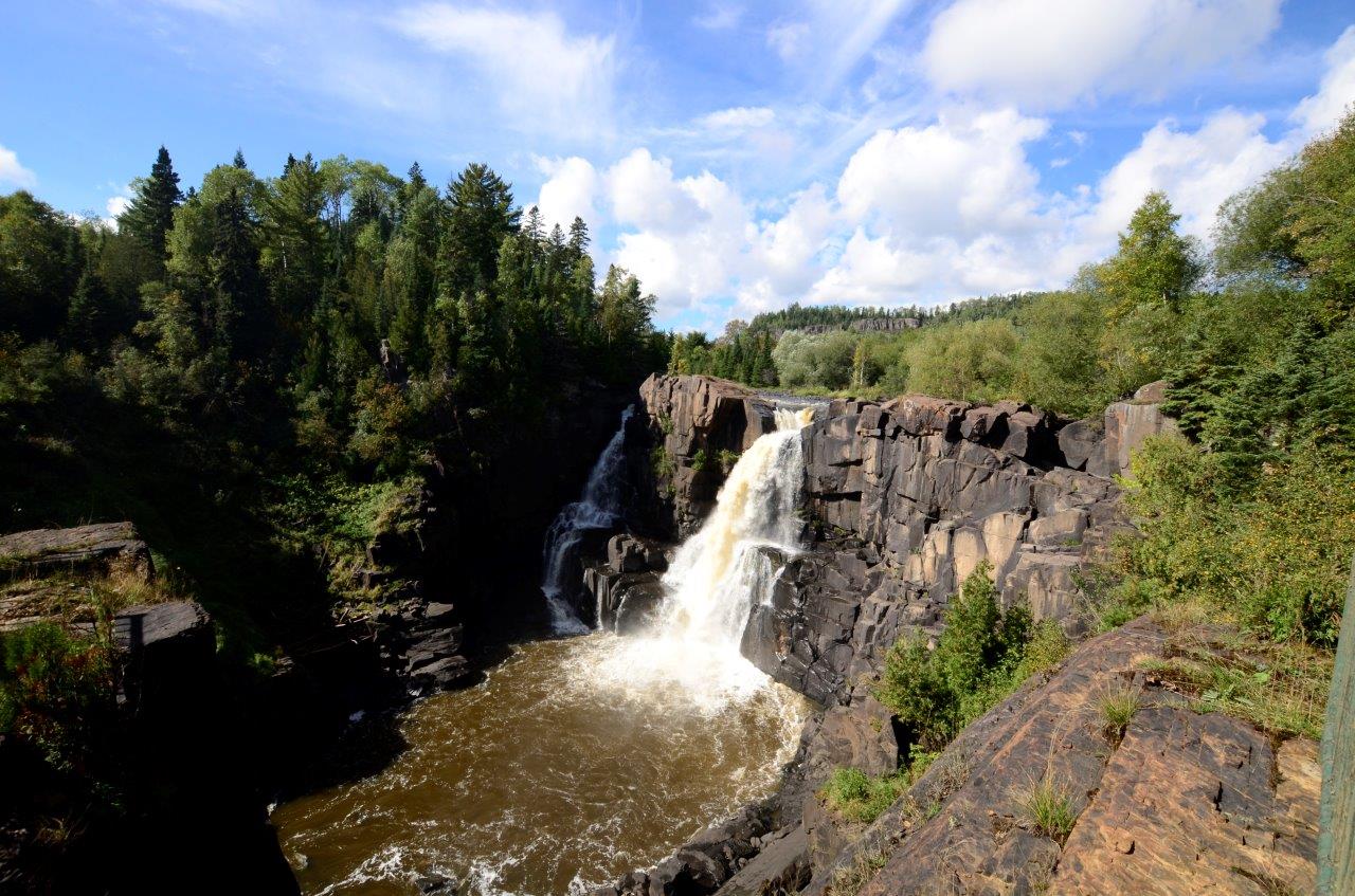
Kakabeka Falls
Probably our easiest iconic vista to reach is the mighty waterfall of Kakabeka Falls Provincial Park.

At 40 m tall, Kakabeka Falls is the second highest waterfall in Ontario, and offers year-round viewing opportunities.
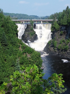
A barrier-free boardwalk from the main parking lot extends around the top of the falls with a series of viewing pods and scenic views of both the waterfall and the Kaministiquia River below.
Extend your stroll along the Mountain Portage Walking Trail (1.25 km loop) to follow in the footsteps of early travelers and voyageurs.
The park is located a short 30 minute drive from Thunder Bay, located directly adjacent to the Trans Canada Highway 11/17, making it a convenient tourism stop for cross-Canada travelers and locals alike.
Ouimet Canyon
Ouimet Canyon offers panoramic views of its 150 m wide gorge and 100 m vertical cliffs from two viewing platforms overlooking the edge of the canyon.
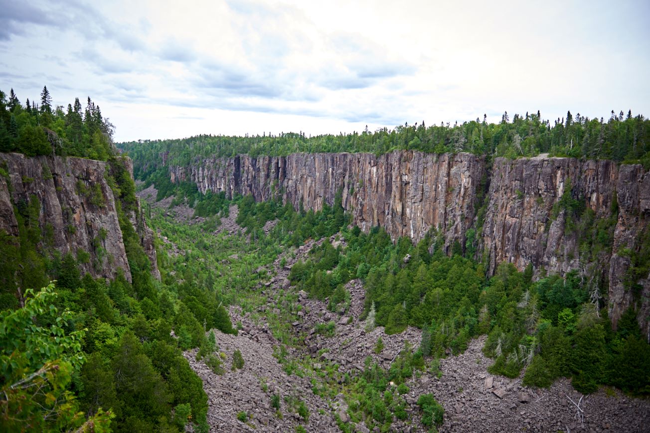
This readily accessible day-use only park features a short 1.7 km loop trail, with sections of boardwalk and gravel offering barrier free access.
This is a nature reserve class park, and access to the bottom of the canyon is restricted to ensure the protection of the arctic and sub-arctic plant species hidden beneath the boulders below.
The canyon’s narrow opening and high walls create a shaded, moist, and cooler climate for these plants which are normally only found 1,000 km to the north. Even during the early summer months, you may be able to see a sprinkling of snow on the insulated canyon floor below.
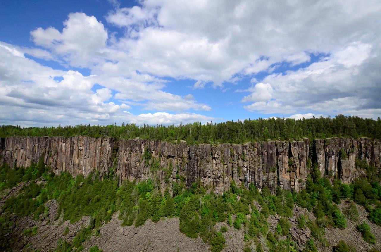
The Canadian geological wonder of Ouimet Canyon Provincial Park is located near Dorion, just over an hour’s drive from Thunder Bay along Highway 17.
Be sure to bring your camera to capture this eye-opening panoramic view.
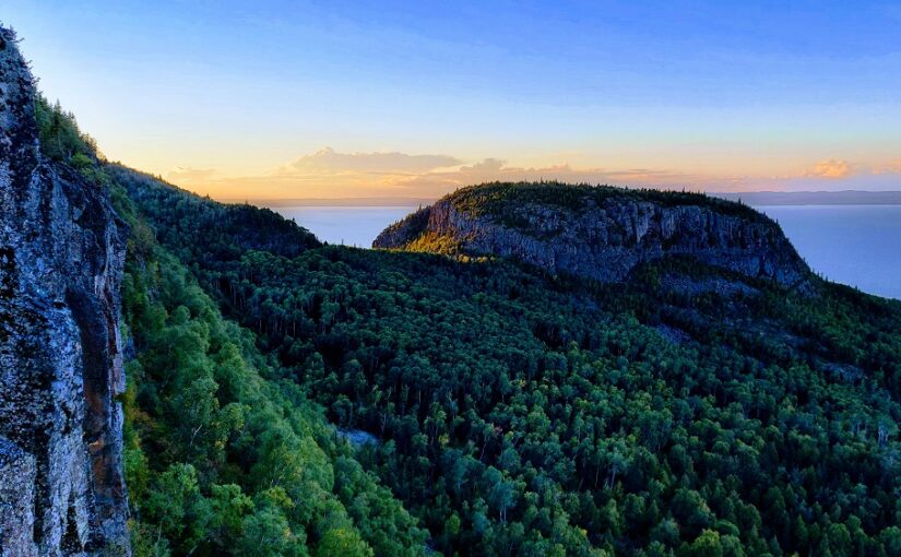
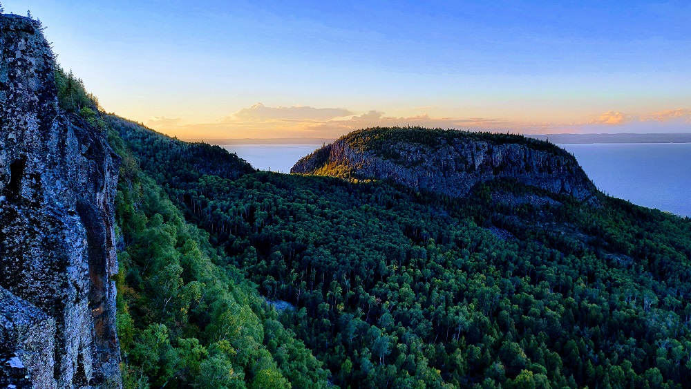
Thunder Bay Lookout
Looking for a driving tour or challenging mountain bike ride with an iconic vista only footsteps away from your arrival point?
Head to Sleeping Giant Provincial Park and the Rita Lake Road turnoff. Accessing this vista may actually be a little more challenging for your vehicle than for you.
Be sure your vehicle offers adequate clearance for this bumpy gravel road. The 9 km drive in from Highway 587 will take about 20 minutes.
Take it slow and gentle.
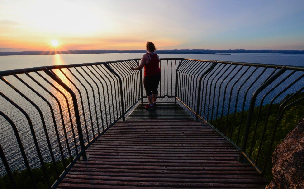
Once there, it’s up to you to brave the viewing platform which — oh yes — extends out over the park’s soaring cliff face, allowing downward views through the platform’s metal rails to the boulder landscape below.
There are some park visitors that just can’t make it to the end of this viewing platform and prefer to hug the rocks closer to the parking area. Whether you make it to the end or hug the rocks, this iconic vista is spectacular and road accessible.
Just remember, don’t look down. Instead, look up and out over the vastness of Lake Superior towards the view of the City of Thunder Bay.
If you’re there at sunset, bring your camera to capture the warm colours of the sunlight dancing off the cliffs as the sun drops below the horizon.
High Falls
Another of our day use only parks, Pigeon River Provincial Park offers a network of trails that can keep you hiking for a full day.
One of the most popular routes is High Falls Trail, a 2.5 km loop which takes you along old logging roads up to the iconic vista of High Falls. Measuring 28 m in height, this waterfall straddles the Ontario–Minnesota border and is also known as “Pigeon Falls” on the American side.
This is the closest provincial park you’ll find to the Pigeon River International Border Crossing.
For travellers driving the Lake Superior Circle Tour Route, this is a great place to get out and stretch your legs. Be sure to explore the park’s trails to find other exciting views of the park, Lake Superior, and Middle Falls as well!
Pic Island Overlook
Are you inspired by the Group of Seven’s art? Interested in retracing their footsteps to the exact location where the famous Pic Island sketches and paintings were created?
Be sure to visit Neys Provincial Park and head over to the Pic Island Overlook Trail.
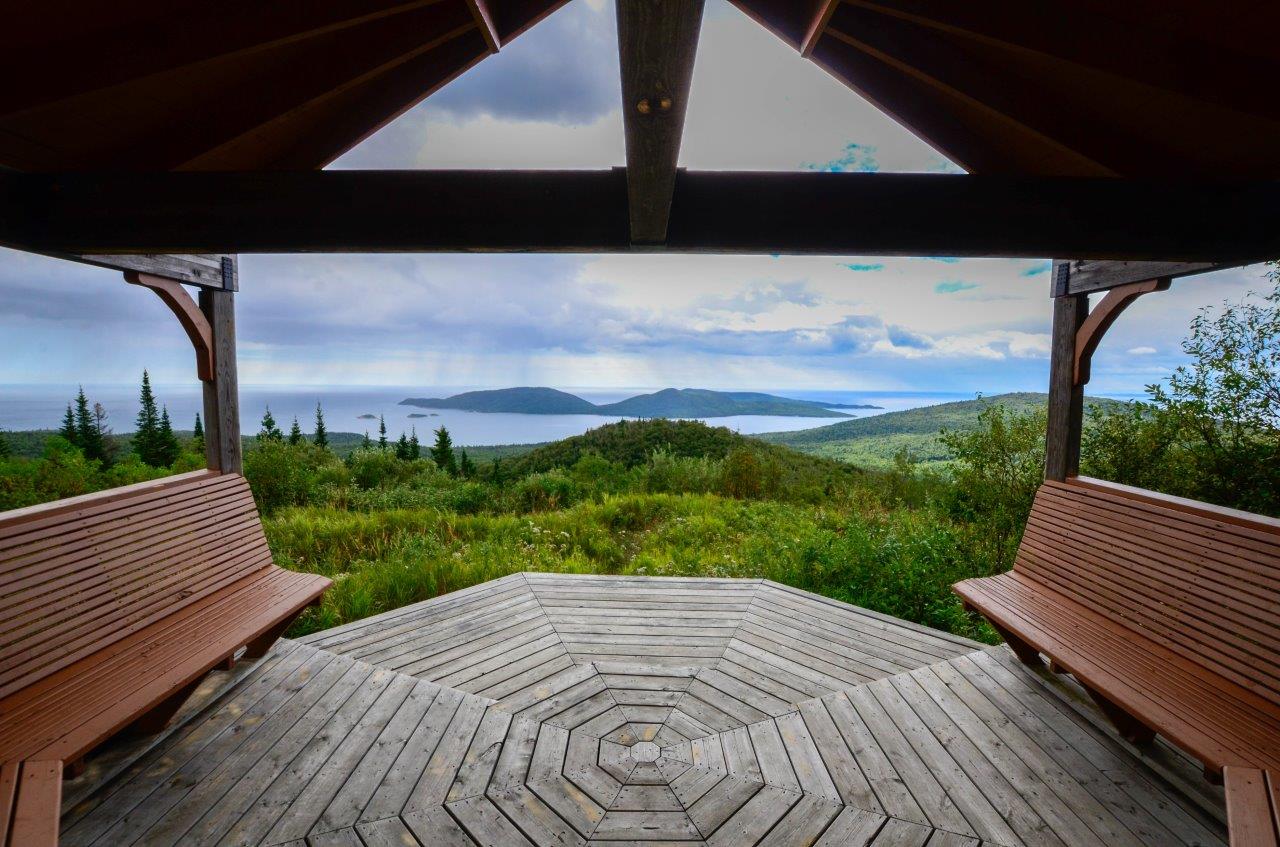
This 4.5 km linear trail (9 km return) twists and winds its way along a dirt road and up a hill to the iconic vistas of Pic Island and Thompson Channel.
Why not bring your own art supplies with you, relax in the pagoda at the top, and spend some time immortalizing the Pic Island view like Lawren Harris?
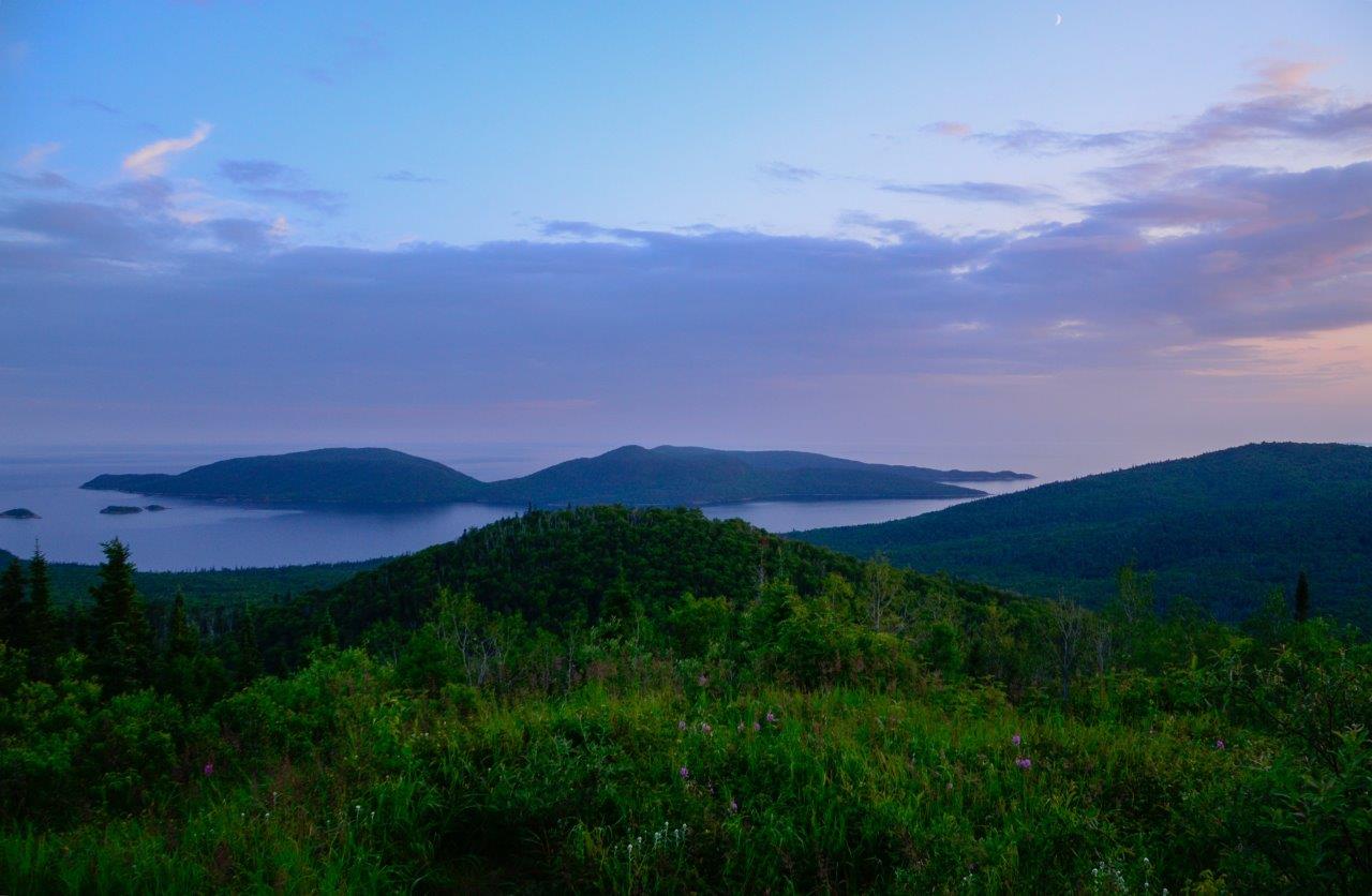
When the weather is moodier, the Group of Seven feeling is truly alive here. Allow at least three hours for this steady upward hike to your iconic reward.
Good news: the hike back is basically all downhill!
Nokomis Trail
Want to view the grandeur of Lake Superior year-round? The Nokomis Trail in Lake Superior Provincial Park is sure to deliver.
Plan to spend at least a couple hours exploring this trail leading to the iconic vista over Old Woman Bay of Lake Superior.
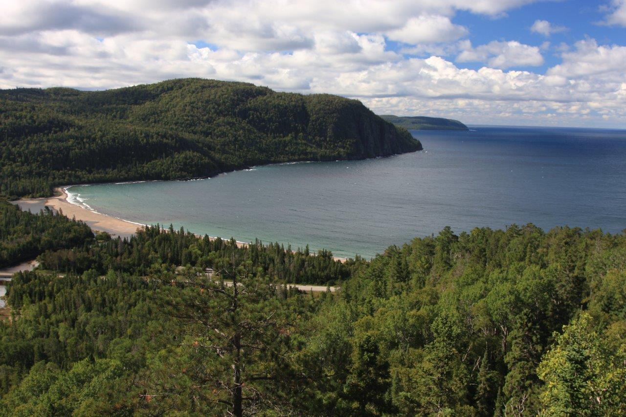
This moderately difficult 5 km loop begins across the road from the Old Woman Bay parking lot on Trans Canada Highway 17. Follow the trail’s steady upward climb through the lichen-draped boreal forest.
Once at the vista, see if you can find the face of an old woman immortalized on the far shore cliffs, rising 200 m above Lake Superior.
The Nokomis Trail is ranked among the top five day hikes in Canada (Lonely Planet’s “Discover Canada” Guidebook). Whether you’re just passing through or staying in one of the park’s two campgrounds, be sure to check this trail out.
Nanabosho Lookout Trail
The Nanabosho Lookout Trail is the least travelled of the three trails that ascend the Sleeping Giant.
The lookout’s north-facing vantage point rewards adventurous hikers with stunning panoramas of the entire Sibley Peninsula, which is unlike any other viewpoint in the park. At over 500 m in elevation, the halfway point of this 0.8 km trail is the highest point on the park’s elaborate trail network.
Note that the total distance to the end of the Nanabosho Lookout Trail and back is 15 km (7.5 km each way). This takes most hikers about 5-6 hours to complete.
The trail can be accessed via the Sawbill Lake Trail (2 km) to the Sawyers Bay Trail (2.9 km).
From there, the first 1.8 km of the Talus Lake Trail climbs more than 200 metres before arriving at the Nanabosho Lookout Trailhead. The Nanabosho Lookout Trail then continues to steeply climb until topping out at the halfway point followed by a gentle decline to the spectacular lookout.
A small parking areas is located at the Sawbill Lake Trailhead on Marie Louise Drive just 2.5 km from the park’s main campground.
The Nanabosho Lookout Trail is one of the park’s hidden gems and is worth exploring whether it’s your first or fiftieth trip to Sleeping Giant Provincial Park.
So if you’re looking for iconic vistas this season, be sure to make plans with family and friends to get outside in nature and visit Ontario Parks’ northwest!
We will leave you breathless.